Photo spot in Carnac, Quiberon & the Gulf of Morbihan
The Ménec and Kermario alignments
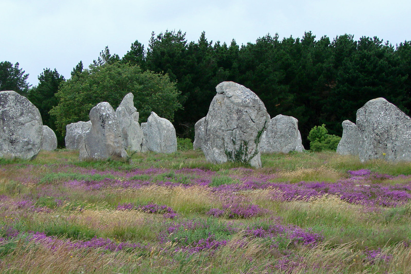
Rows of standing stones running for kilometres across the heath — the largest concentration of megaliths in the world, and purple with heather in September.
About The Ménec and Kermario alignments
Get directionsCarnac's alignments are three separate fields of standing stones set in long parallel rows across a low heath: Le Ménec at the western end, where eleven rows run for about a kilometre and a stone circle survives at each end; Kermario in the middle, with the tallest menhirs of the three; and Kerlescan beyond. They were raised between roughly 4500 and 3300 BC, nobody knows why, and in July 2025 they were added to the UNESCO World Heritage List.
The frame that works is along the rows, not across them — stand at one end of a line and let the stones recede, which turns three thousand grey blocks into repetition and scale. Low sun does the rest: side light at sunrise or in the last hour separates each stone from the next, while midday flattens the whole field into a grey scatter.
Season changes the ground more than the stones. From late July into September the heath goes purple with heather and yellow with gorse, which is the single best month to be here. The rest of the year the ground is bleached grass and the sky has to carry the picture.
The practical point nobody mentions on the postcards: the fields are fenced for most of the year to let the heath recover, so from spring to early autumn you photograph from the perimeter path or from a guided walk booked at the Maison des Mégalithes. In winter the gates open and you can walk in among the stones. Dates and rules change every season — check with the site rather than turning up and hoping.
Best time to shoot
Sunrise or the last hour; late August and September for purple heather
Tips
Shoot along the rows, not across them. The fields are fenced through the growing season — check access and guided-walk times with the Maison des Mégalithes before your date.
Photographers who shoot at The Ménec and Kermario alignments
Hand-picked professionals working in Carnac, Quiberon & the Gulf of Morbihan
Other spots in Carnac, Quiberon & the Gulf of Morbihan
The Côte Sauvage, Quiberon
Ten kilometres of low granite cliff, arches and blowholes down the western side of the Quiberon peninsula, with Atlantic swell arriving unbroken.
The Gulf of Morbihan from Larmor-Baden
A shallow inland sea of wooded islands, oyster racks and moored boats — seen from the low headlands and shore path west of Vannes.
Vannes: the old town and the ramparts gardens
Half-timbered houses leaning over the lanes, a complete ring of medieval walls, and formal gardens laid out along the moat below them.
Ready to book?
Our concierge team will hand-pick 2-3 photographers who know The Ménec and Kermario alignments — free of charge.